Image showing rain clouds gathering over Maharashtra as IMD predicts very heavy monsoon rainfall across central & eastern India.
Heavy Rains to Devastate Parts of India — IMD Signals Monsoon May Begin Withdrawing from Rajasthan Around Sept 15
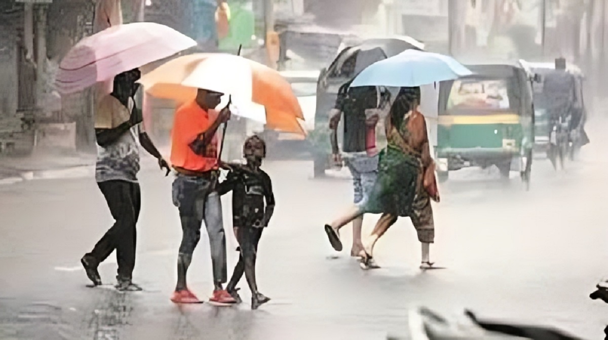
Breaking now — The India Meteorological Department (IMD) has issued an urgent weather alert: renewed heavy to very heavy monsoon rainfall is set to drench major states like Maharashtra, Telangana, Odisha, even as signs emerge that the monsoon may finally begin its withdrawal from West Rajasthan around September 15, 2025. The clash of intense downpours and the onset of retreat has alarmed meteorologists, with residents bracing for disruptions and damage — especially where past rains have already battered infrastructure.
Key Points
IMD forecasts heavy to very heavy rainfall across Maharashtra, Telangana, Odisha, and adjoining eastern & central states between September 13–17.
A low-pressure area over the west-central & northwest Bay of Bengal is fueling the system.
Signs point to the southwest monsoon beginning its withdrawal from parts of West Rajasthan around September 15, earlier than usual.
Orange alerts issued; risks include flooding, landslides, disruption to transport, especially in hilly and low-lying areas.
New Delhi (Star Struck Times) — As September progresses, India finds itself in a dramatic phase of the monsoon season. Rather than winding down smoothly, the rains are intensifying in parts even as the monsoon’s withdrawal phase sparks to life in others.
According to the latest IMD press release, a low-pressure area over west-central Bay of Bengal adjoining north Andhra Pradesh and south Odisha coasts is moving west-northwestward across south Odisha into north Andhra Pradesh and south Chhattisgarh over the coming days. This system is expected to trigger heavy to very heavy rainfall over Odisha, Coastal Andhra Pradesh & Yanam (Sept 13-14), Telangana (Sept 13-17, very heavy especially Sept 13), and over Maharashtra from Sept 13-15, especially in the Coastal Konkan & Goa and Madhya Maharashtra / Marathwada regions.
Even more notably, IMD has signaled that conditions are becoming favourable for the southwest monsoon to begin withdrawing from some parts of West Rajasthan around September 15, 2025.
What the Forecast Means — States Under Threat & Timeline
Here’s a state-wise breakdown, with what people living in vulnerable regions need to know:
State / Region
Expectation
Timeline
Major Risks
Telangana
Very heavy downpours especially early on; rainfall likely to be intense on Sept 13.
Sept 13-17
Flooding, waterlogging, disruption of transport, damage to crops already in vulnerable state.
Maharashtra (Coastal & inland)
Heavy to very heavy rainfall; Konkan & Goa being hit hardest.
Sept 13-15 (Coastal) & into Sept 15 inland
Landslides, urban flooding (especially Mumbai, Pune), danger in hilly/mountainous regions.
Odisha, Coastal Andhra Pradesh & Yanam
Heavy rainfall particularly on Sept 13-14.
Sept 13-14
Coastal flooding, storm surges, damage to fishing communities.
East & Central India (Chhattisgarh, Vidarbha, etc.)
Isolated heavy rainfall episodes; risk increasing over Sept 13-16.
Sept 13-16
Crop damage (standing crops), waterlogging, local infrastructure stress.
West Rajasthan
Beginning signs of monsoon withdrawal (drop in moisture, fewer rains).
Around Sept 15
Drying soils, possible water shortage; relief from rains for now.
Why Monsoon Withdrawal Is So Hard to Pin Down
While “withdrawal of monsoon” sounds definitive, experts caution that it’s a gradual and somewhat subjective process. Key markers include:
Cessation of rainfall over a region for several days.
Sharp decline in moisture content — measurable via satellite / atmospheric data.
Establishment of anti-cyclone over the withdrawing region (e.g. West Rajasthan).
For example, IMD Director General Mrutyunjay Mohapatra has noted that rainfall must essentially drop off for five days and moisture levels must fall: only then can withdrawal be declared.
The Big Picture: September’s Expected Intensity
Earlier forecasts had already set the stage: IMD predicted above-average rainfall for September, with precipitation across much of India expected around 109% of long-period average.
But while above-normal rainfall helps recharge ground water, reservoirs, and benefits agriculture, it also raises multiple risks: flash floods, urban water-logging, landslides, disruption of road, rail & air travel; and damage to crops that are close to harvest. Particularly vulnerable are regions with poor drainage, deforested hillsides, and towns with aging infrastructure.
Voices from the Ground: Scientists & Local Impacts
G. P. Sharma, president of Skymet Weather Services, explains:
“Unlike the onset of monsoon, withdrawal is a more subjective process. The key criteria include cessation of rainfall activity for at least five days, a sharp drop in moisture levels … Of these, rainfall is the most visible sign — if it keeps raining, withdrawal cannot be declared.”
Local residents in affected districts already report soggy mornings, clogged drains, and houses threatened by slippery slopes. Farmers especially worry: crops that are nearly ready for harvest (for example in Telangana, Vidarbha, Odisha) could suffer severe losses if rains intensify or linger beyond safe windows.
What You Should Do: Preparedness Tips
Stay updated with local IMD / state meteorological bulletins. Alerts may be upgraded.
Avoid travel during peak rainfall days, especially in hilly or flood-prone terrain.
The monsoon withdrawal from West Rajasthan around Sept 15 is significant for many reasons:
It signals that the long monsoon season is tapering off in northwest India. Normally, the monsoon starts retreating around mid-September.
But even as it withdraws in the northwest, heavy rains persist elsewhere due to systems like that Bay of Bengal low pressure.
So, we have a simultaneous paradox: retreat in one region, intensification in others. For farmers, city planners, disaster-management agencies, that makes planning harder.
FAQs
Q1: What exactly is a “low-pressure area” and why does it matter? A low-pressure area is a region in the atmosphere where pressure is lower than surrounding areas. It draws in moist air and often leads to cloud formation and heavy rainfall. In this case, the low pressure over the Bay of Bengal is feeding moisture and driving strong rains in eastern and central India.
Q2: When does monsoon normally withdraw from West Rajasthan? Traditionally, the southwest monsoon begins to withdraw from parts of West Rajasthan around September 17. IMD now expects that to happen around September 15, 2025, a few days ahead.
Q3: Will heavy rains affect harvests this season? Yes. Crops that are mature or near harvest are vulnerable. Excessive water can cause rotting, lodging (when crops fall over), and disrupt harvesting schedules. States like Maharashtra (Marathwada, Vidarbha), Telangana and Odisha are under particular risk.
Q4: Are all states equally at danger from these rains? No. Risk is higher in areas with steep terrain, poor drainage, or those already saturated by prior rainfall. Coastal regions, hilly states like Uttarakhand, Northeast India, and urban zones with weak stormwater systems are especially vulnerable.
Why This Matters (Trend & Urgency)
With climate change, weather extremes are becoming more common: intense rainfall, delayed withdrawal, erratic behavior of monsoon systems. This isn’t just about wet weather: it’s about human lives, livelihoods, agriculture, infrastructure. An above-average monsoon may sound good on paper, but severe rain events can irreversibly damage crops, destroy roads, disrupt power and communication, especially in poorer or remote areas.
There is also a growing pattern: rainfall in September and even late September being more intense than before. Some scientists believe that this shift in timing and behavior of monsoonal systems demands more robust disaster management and long-term climate adaptation.
Conclusion
The IMD’s warning of renewed heavy monsoon rainfall over Maharashtra, Telangana, Odisha, and central/eastern India, set against the backdrop of monsoon withdrawal from parts of Rajasthan around September 15, frames a critical moment. Communities, farmers, local governments: the time to prepare is now.
Have you updated your emergency plan yet? If you live in one of the states under alert, review your supplies, drainage systems, and safety routes today. Share this article with friends or family in affected areas to make sure they are prepared — every hour matters.
If you’re in Maharashtra, Telangana, Odisha, or West Rajasthan — what preparations are you making ahead of the rains or the withdrawal? Tell us in the comments.
Hello! I'm M Muzamil Shami, the founder and lead editor of Star Struck Times, your trusted source for trending news, entertainment scoops, celebrity gossip, sports highlights, and global headlines.
With a passion for storytelling and journalism, I created this platform to bring you breaking news, viral moments, and deep insights into the worlds of Bollywood, Hollywood, sports, politics, tech, and more — all in one place.